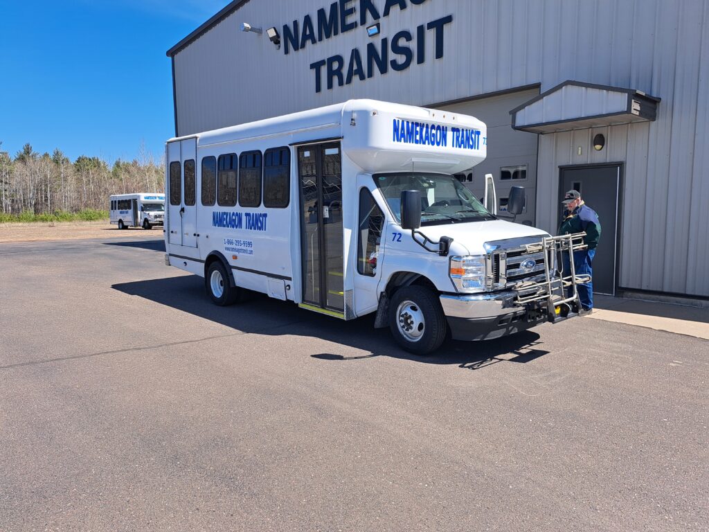
Serving Sawyer, Barron, Washburn,  Southern Bayfield Counties and the Lac Courte Oreilles Reservation.


Location

Sawyer County is located in the northwest corner of Wisconsin, about 70 miles south of Lake Superior.

 
Size: Sawyer County is the fifth largest county in Wisconsin by area, covering 1,257.6 square miles of land. 


Population

As of 2020, the population of Sawyer County was 18,074.  


County seat

The county seat of Sawyer County is Hayward. 

 
History

Sawyer County was formed in 1883 from parts of Ashland and Chippewa counties.  Logging was a major industry in the area from the 1870s to the early 1900s. 


Vegetation

The county's vegetation includes maple, hemlock, yellow birch, white pine, red pine, jack pine, and prairie grasses. 


Industries

Lumbering and tourism are still major industries in Sawyer County.

  
Attractions

The Hayward Lakes Area is a good base camp for exploring the many natural wonders and attractions of Wisconsin's Northwoods including the Lumberjack World Championships and the American Birkebeiner. The Fishing Hall of Fame is located in Hayward, and the county holds the current World Record Muskie honor. 


Location:
The reservation is located in northwest Wisconsin, mostly in Sawyer County, and is about halfway between Milwaukee and the U.S.-Canadian border. It is also about 11 miles southeast of Hayward, the county seat of Sawyer County. 
 
  • Size:
    The reservation is 76,465 acres, with about 10,500 acres of lakes. 
     
  • Land ownership:
    The land is divided into tribally owned, individually allotted, and fee land. The reservation also has trust land in Burnett and Washburn counties. 
     
  • History:
    The reservation was established in 1854 by the second Treaty of La Pointe. The name comes from the lake on the eastern border, which was called Lac Courte Oreilles by French fur traders in the 1800s. 
     
  • Population:
    As of 2020, the reservation had a population of 2,968 people. The most populated community is Little Round Lake. 
     
  • Subsistence:
    The people of the reservation continue to practice traditional subsistence by hunting, fishing, and gathering. 
     
  • Language:
    Ojibwe language is taught at the reservation by teachers who are knowledgeable in the language and culture. 
     

Location

Barron County is located in northwestern Wisconsin, between the Chippewa and St. Croix rivers. It's 50 miles north of Eau Claire, 80 miles northeast of Minneapolis/St. Paul and 100 miles south of Duluth and Superior. 


Size

Barron County is 863.1 square miles, making it the 24th largest county in Wisconsin by area.


Population

As of 2020, the population of Barron County was 46,711. 


County seat

The county seat of Barron County is Barron. 


History: 

Barron County was created in 1859 and organized in 1874. 


Services:

 Barron County offers a variety of services, including youth and family services, public health services, and more. 


Landscape: 

Barron County's landscape is characterized by rolling hills and vales, with a predominant southwesterly declination. 


Notable events: 

Some notable events in Barron's history include the Gordon Bakery fire in 1908, the founding of the Barron Cooperative Creamery in 1902, and the founding of Jerome Foods in 1922. 


Location: 

Washburn County is in the northwest region of Wisconsin, about 40 miles south of Superior and 75 miles northeast of Minneapolis.  


Size:

 The county is 853 square miles, covering 36 miles north to south and 24 miles east to west.

 
Population: 

The 2020 census reported a population of 16,623. 


County seat

The county seat is Shell Lake. 


History

The county was created in 1883 from a portion of Burnett County and named after Cadwallader C. Washburn, a former Wisconsin Governor and Union General in the Civil War. 


Attractions: 

 Washburn County has many attractions, including restaurants, campgrounds, RV parks, and cabins. 


Land: 

The county has 964 lakes, including 31,265 acres in lakes. The major watersheds are the St. Croix River (North) and Chippewa River (South).  


Rivers:

 The county's rivers include the Brill, Clam, Namekagon, Totagatic, and Yellow.  


Location

Bayfield County is in the Northern Highlands geographical province.


Size: 

Bayfield County is the second largest county in Wisconsin by area, covering about 966,000 acres.


Population

The 2020 census recorded a population of 16,220.  


County seat: 

The county seat is Washburn. 


Landscape: 

Bayfield County has a varied landscape, including the Bayfield Peninsula, sandstone cliffs, and inland lakes. 


National treasures

Bayfield County is home to seven national designations, including the Apostle Islands National Lakeshore, Chequamegon-Nicolet National Forest, and Frog Bay Tribal National Park.  


History: 

Bayfield County was created in 1845 and organized in 1850.  


Largest employer

The Red Cliff Band of Lake Superior Chippewa has a reservation in Bayfield County and is the county's largest employer.

 
Elevation:

 The elevation at Washburn is 654 ft, and at Bayfield Lookout Tower it is 1,368 ft.  


Number of lakes:

 Bayfield County has 962 lakes.